How laser can be used in Imaging,Detection,Ranging?
Since the invention of the laser in the 1960s, laser scientists and engineers have been using them to image, detect, and find ranges to objects. In fact, on Apollo 15 in 1971 astronauts used a laser system to map the surface of the Moon. This type of implementation is known as laser imaging, detection, and ranging or LIDAR (and like laser is now often written in the lower case as a word). Lidar is implemented by using pulsed or modulated laser beams and laser detectors to determine precise distances to objects. Figure below shows a basic configuration for a lidar system.
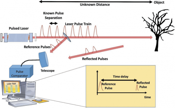
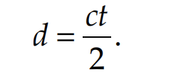
The laser pulses are split just outside the laser output coupler and one beam is directed to the receiving components (typically a telescope with photon counting detectors) while the other portion of the beam is directed onward to a distant object. Using the split beam as time reference the reflected beam’s return time is then compared and the difference between them will be twice the travel time required for the light to travel from the laser to the object. This allows for the distance to be determined as
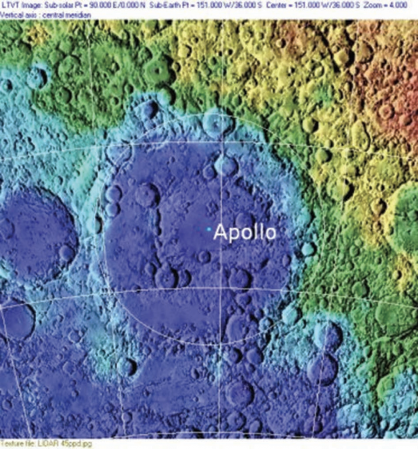
The lidar receiver will likely see returned light from particles in the air, multiple objects along the way, and any background (such as the ground or buildings). The various return times are used to map the various return distances to objects and therefore a three-dimensional map can be generated of the area being scanned. Figure below shows a lidar image of the Apollo Basin on the Moon taken from the Clementine LIDAR Altimeter instrument in 1994.